
Keyword
Earth Science | Oceans | Ocean Chemistry | Organic Matter
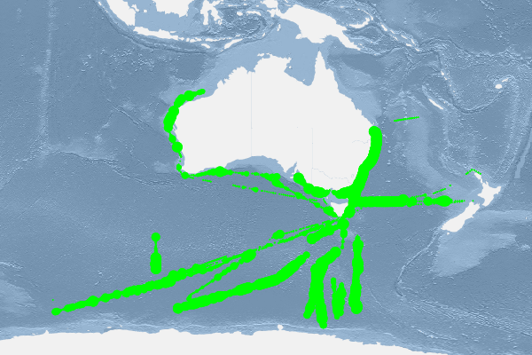
43 record(s)
Type of resources
Topics
Keywords
Contact for the resource
Provided by
Formats
Update frequencies
Status
draft
-
Sentinel-3 OLCI full resolution (approximately 300m-pixel size) daily reprojected Level 2P water quality (Chl-a, CDOM, TSS) produced by CSIRO under eReefs Phase 5 using the FUB-CSIRO Coastal Water Processor (detailed description at https://doi.org/10.1016/j.rse.2021.112848). This product was derived from Level 2 geophysical quantities, and placed onto a regular grid using nearest neighbor resampling. Standard Level 1 quality flags have been applied to pre-mask and quality control the data (see file_version_quality_control). Additional algorithm input and output out-of-range flags (in_out_OR_combined_flags) are provided to further quality control the data. These flags have not been applied to pre-mask the data.
-
Benthic water quality measurements were obtained from nine sites across and outside Marmion Lagoon at varying depths (3m, 5m, 10m, 15m, 20m, 25m, 30m, 35m and 40m). Data was collected on Total Suspended Solids (TSS), Particulate Organic Matter (POM), Particulate Inorganic Matter(PIM), Chlorophyll-a, Phaeopigments, HPLC, Fatty acids, Nutrient Concentrations and Isotopes over December 2008 to March 2009.
-
Process Study 2 was undertaken between 20-22 September 2005 in the Huon Estuary offshore from Hideaway Bay. During this Process Study, two sediment traps were deployed at each of two sites (near sites P3 and P4 from the spatial survey) on the bottom for 24 hours.Prior to the deployment of the traps surface sediment samples were collected with a benthic grab from each site. Each sediment trap consisted of three collection tubes, material from each tube was filtered on 47 mm GFF filters, with several filters required to filter all of the particualte matter from each tube. Combined filters from each of two tubes labeled A and B (typically 3 filters for each tube) were extracted for lipid analysis. Tube C was used either for isotopes or Fauna indent.
-
Process Study 3 was undertaken between 03-05 October 2006 in North West Bay. Sediment traps were deployed and sediment samples taken at five sites in NWB. The primary aim was to investigate the composition of material being deposited to the sediments from the water column at these times and to compare this organic matter with that found in the sediments at the same sites. Additionally, we wished to see whether any organic matter of obvious fish farm origin could be detected. One sediment trap was deployed at each North West Bay (NWB) site in water varying in depth from 10 m (site 9) to 20 m (site 2). The trap sites were numbered 2, 4, 5, 7, and 9. Traps were deployed at their respective sites and left for at least one hour before the caps were removed in order to eliminate sediment re-suspended during deployment from entering the traps. The traps were left in place for 48 hours and then retrieved, capped and returned to Hobart for recovery of the samples. Each trap had 3 tubes, each of these tubes was split into three. One litre was taken and filtered for lipids using pre-weighed 47 mm GFF filters, one litre for pigments and the rest was split in two and stored in 500ml bottles, one for zooplankton analysis and the other for microalgal samples. Several filters were required to filter the lipid sample depending on the amount of particles in the tube. Selected filters were then analysed for lipid biomarkers. Organic matter from selected filters was also analysed for stable isotope 13C and 15 N values and carbon content. The contents of one tube from each trap was inspected for identification of zooplankton remains and faecal pellets using light microscopy. Sediments were collected at each of the above trap sites using a Wilco box corer.
-
Process Study 1 was undertaken between 12-14 April 2005 in the Huon Estuary offshore from Hideaway Bay. During this Process Study, two sediment traps were deployed at each of two sites (near sites P3 and P4 from the spatial survey) on the bottom for 24 hours.Prior to the deployment of the traps surface sediment samples were collected with a benthic grab from each site. Each sediment trap consisted of three collection tubes, material from each tube was filtered on 47 mm GFF filters, with several filters required to filter all of the particualte matter from each tube. Combined filters from each of two tubes labeled A and B (typically 3 filters for each tube) were extracted for lipid analysis. Tube C was used either for isotopes or Fauna indent.
-

The Theme 5.3 study was undertaken to improve our understanding of the spatial and temporal patterns in seagrass composition, abundance and reproductive phenology in the Pilbara region. Key environmental parameters, especially light, that influence seagrass survival and can be altered by dredging were also characterised. From August 2013 to March 2015 (18 months), surveys of seagrass abundance were undertaken in the Exmouth Gulf region. The locations surveyed (South Muiron Island, Bundegi and Exmouth Gulf) encompassed a range in water clarity from clear to turbid. Less frequent surveys were undertaken at other locations in the Pilbara: Thevenard Island, Rosemary Island and Balla. Measurements of seagrass abundance were also obtained from monitoring conducted as part of the dredging and dredge-spoil management plan for Chevron Australia's Wheatstone Liquefied Natural Gas (LNG) Project. During each survey measurements were made in the field, photographs were taken or samples were collected in order to measure the following variables: 1. percentage cover of seagrass and other benthos; 2. above- and below-ground biomass, shoot density, leaf length, leaf width and number of flowers; 3. density of seagrass seeds; 4. sediment grain size; 5. stable isotope ratios (Ô13C and Ô15N) of seagrass leaf tissue; and 6. water quality (light, conductivity, temperature, salinity, nutrients, suspended particulate matter and chlorophyll).
-

The Australian Continuous Plankton Recorder (AusCPR) survey is a joint project between CSIRO Oceans and Atmosphere (O&A) and the Australian Antarctic Division (AAD) to measure plankton communities as a guide to the health of Australia's oceans. The biomass is analysed from the same segment from which the zooplankton is analysed. All the plankton is washed onto a pre-weighed filter. This is left in an oven at 60 degrees C for 24-48 hours. It is reweighed to give the dry weight. It is advised that anyone using the data should contact the project contact person. The aims of the AusCPR survey are to: * map plankton biodiversity and distribution * develop the first long-term plankton baseline for Australian waters * document plankton changes in response to climate change * provide indices for fisheries management * detect harmful algal blooms * validate satellite remote sensing * initialise and test ecosystem models. Servicing and maintenance of the CPRs and analysis of the samples for the AusCPR survey will be carried out by staff based at the O&A CSIRO laboratories in Queensland and Hobart and at the AAD in Hobart. The project was funded by the Integrated Marine Observing System (IMOS) and falls with the Ships of Opportunity facility. Data storage and access is planned to be interoperable with other national and international programs through the IMOS Infrastructure. Results from the AusCPR survey are available through the AODN portal: https://portal.aodn.org.au. This data is freely available but please acknowledge all relevant parties, as detailed in acknowledgement section.
-
The Huon Estuary Study was undertaken by CSIRO Marine Research between 1996 and 1998. The Huon Estuary is in South Eastern Tasmania. This record references the optical absorption data from both the spatial (HES) and the weekly monitoring (CM) surveys of the Huon Estuary Study. This dataset includes phytoplankton, spectral absorption and HPLC pigments. Final data for the pigment and phytoplankton data has been stored within the HES database which has been refered to by metadata record 'Huon Estuary Study 1996/1998 - Database'. The final datasets have also been written to cdrom as text files for archiving purposes by the Data Centre, Hobart. The spectral absortion data is scheduled to be reworked and will be added to the archive when it becomes available.
-
Phytoplankton Colour Index (PCI) After the silk has been marked into 5 nautical mile samples but prior to cutting, each sample is visually assigned a greenness index by comparison with standard colour charts: viz. no colour, very pale green, pale green, and green. These four levels of the phytoplankton colour index (PCI) represent the amount of phytoplankton pigment on the silk and have been assigned numerical values on a ratio scale based on acetone extracts using spectrophotometric methods. Results from the AusCPR survey are available through the AODN portal: https://portal.aodn.org.au This data is freely available but please acknowledgment all relevant parties, as detailed in acknowledgement section.
-
This record describes sediment trap data obtained with the SAZ16 Sediment Trap, collected on the Marine National Facility RV Investigator voyage IN2015_V01, departing Hobart on the 21st March and returning to Hobart on the 29th of March, 2015. The SAZ sediment trap mooring focuses on quantifying the transfer of carbon and other nutrients to the ocean interior by sinking particles, and collecting samples to investigate their ecological controls. SAZ16 Sediment Traps were recovered and data downloaded from sediment trap controller computers.